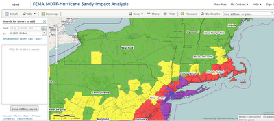
GIS Analysis of Sandy disaster and its impact by Esri is available on following link. GIS is such a great tool to identify & manage the disaster. It give detail analysis of the affected area. In following application Esri has created the impact map of Sandy Disaster Link : http://fema.maps.arcgis.com/home/webmap/viewer.html?webmap=307dd522499d4a44a33d7296a5da5ea0